
Finding Liberty Residents
The most dependable Liberty residents search is a short source ladder, not a single name search. Start with the address, parcel, case number, or date range already known. Clay County’s public property tools can connect an address to a parcel record. The Recorder can then confirm an instrument by party name or book and page. For historical work, a directory or archive item may establish a household at a particular time. A court entry, voter status result, or business filing needs a narrower purpose and more care.
Each source has a different role. An owner on a parcel card is not automatically the person living there. A name in a court docket is not proof of residence or wrongdoing. A historical telephone listing is a dated lead, not a current roster. Keeping the source type, date, and matching detail together makes the Liberty residents directory useful without turning a record trail into a personal profile.
- Use a known Liberty address in the Clay County parcel search to find the situs and parcel identifiers.
- Compare the assessor’s deed reference with the ClayDeeds party or book-and-page index.
- For a current personal matter, use the Missouri voter portal only for the exact registered information it requires.
- For an older household, check directory, newspaper, cemetery, and archive material by year and spelling variant.
- Ask the custodian or repository for a narrow, dated request when an index does not expose the needed item.
Liberty Resident Records Offices
Liberty is the Clay County seat, so several key offices sit in or serve the city. The county Assessor and GIS tools supply current parcel context. The Recorder of Deeds preserves recorded instruments. The election authority manages voter-registration work, while the city and state archives keep the historical layer. These offices do not maintain one universal residents list. Together, they provide separate clues that should be checked against the record’s date and purpose.
Clay County Recorder of Deeds
1 Courthouse Square
Liberty, MO 64068
816-407-3550
Clay County Assessor
Clay County assessment and GIS services
Liberty, Missouri
816-407-3500
Clay County Board of Elections
100 W Mississippi St
Liberty, MO 64068
816-415-8683
The full address chain, including parcel geometry and recorded instruments, belongs with the Liberty by-street directory. Here, the practical point is choosing the office that actually holds the record.
The Clay County Recorder’s public office page provides its Liberty access information and records guidance.
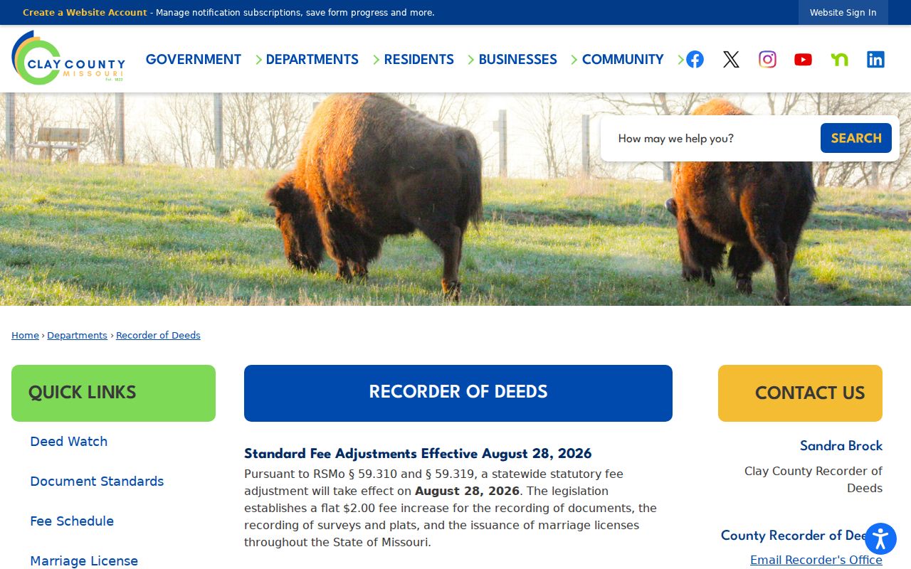
The Recorder’s official page is the right confirmation point when a portal entry needs an office-held or certified copy.
Liberty Parcel Search Fields
The Clay County Assessor Parcel Search is usually the best first stop for a Liberty place. Its selector can use parcel, property, subdivision, or tax-code terms, and its address mode returns scored address matches. Results are capped at 200 and sorted by Parcel ID. A parcel detail can display the Prop ID, Parcel ID, situs, owner or co-owner, map description, use code, tax area, valuation rows, and a Deed tab with instrument, book, page, type, and date.
| Parcel-search field | What it helps establish |
|---|---|
| Parcel ID or Prop ID | County identifier for a specific tax and GIS record. |
| Situs address | Property location, distinct from an owner mailing address. |
| Map description | Orientation aid only, not a legal description. |
| Deed tab book and page | Lead for the Recorder’s recorded-instrument index. |
The Clay County parcel-search screen shows the starting fields used for this Liberty residents directory workflow.
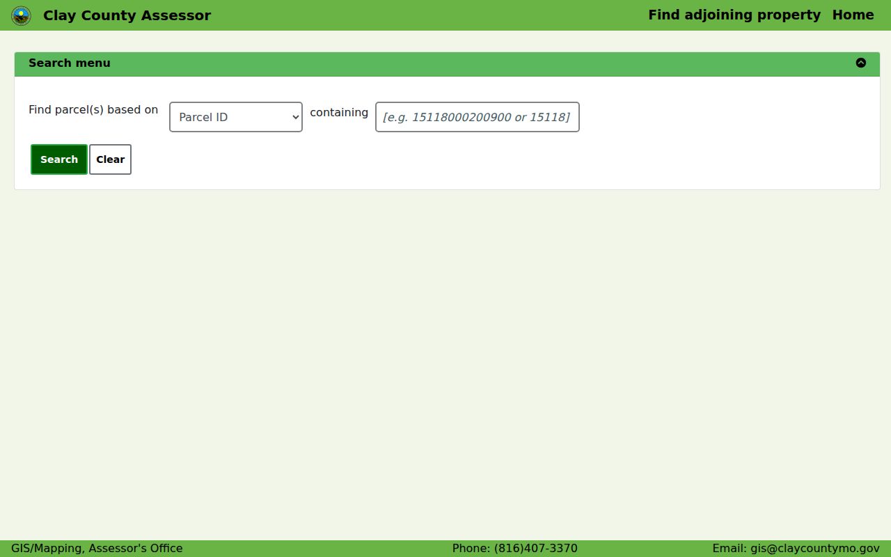
Use a parcel result as a place record, then verify any recorded-document reference with the office that keeps the instrument.
Note: Assessor values are tax information, not a sale-price record or private appraisal.
Liberty Deed Index Limits
ClayDeeds is a strong Liberty records tool after the parcel search has supplied a party name, instrument, or book and page. The Recorder organizes its index alphabetically by name, not by street address. Name searching offers standard, contains-text, and sounds-like modes, party and entity types, first and last or company fields, and date ranges. Book and page, instrument number, financing statement, old-index, and image routes provide additional paths for older material.
The Recorder describes hand-recorded books from 1822 through 1986, an automated database from 1986, daily imaging beginning in August 1999, and internet access described as 1968 to date. Online login is required to search, view, or print images. Older and non-indexed material may require special portal navigation or help from the Recorder. The online record is a convenience copy, not a certified record.
ClayDeeds uses party, date, and book-page controls rather than a Liberty address field.
That distinction is why an assessor deed reference is often the cleanest bridge from a place to a recorded instrument.
Current Liberty Directory Sources
Current Liberty resident sources are purpose-specific. The assessor is a property and tax source. The voter portal is a confirmation tool for exact personal registration details. City staff contacts serve public-office needs, not household searching. The Recorder shows parties to instruments. Treat a result as evidence from that source type, with its own scope and update pattern.
| Liberty source | What it can show | Custodian | Access route |
|---|---|---|---|
| Parcel and tax card | Parcel, situs, ownership context, deed reference | Clay County Assessor | Free public search |
| Recorded instrument index | Grantor, grantee, document date and reference | Clay County Recorder | Portal login or office help |
| Voter registration lookup | Exact-registration confirmation | Missouri Secretary of State | Personal identifiers required |
| City staff directory | Public city department contact | City of Liberty | Public agency directory |
| Municipal and county records | Record-group leads and historical material | State and local archives | Catalog, archive, or request |
A name that needs confirmation across sources belongs with the Liberty resident lookup process, where dates, roles, and identifiers matter more than a single match.
Liberty Voter Record Boundaries
Missouri’s voter lookup is not a public reverse-address roster. The official portal asks for first and last name as registered, date of birth, last four digits of the Social Security number, and county. It also tells users to enter a street name without the street-type word. Exact registered data is necessary, so the tool is best used to check or update an individual’s own registration.
RSMo §115.157 describes public electronic voter fields and also sets boundaries. It does not require a complete public internet file, and commercial use is prohibited. Some residential addresses are protected for qualifying people. The Clay County Board of Elections can help with registration, while the Missouri voter portal is the official online route for exact-entry confirmation.
The Missouri voter lookup displays the identifying fields it requires before a search is submitted.
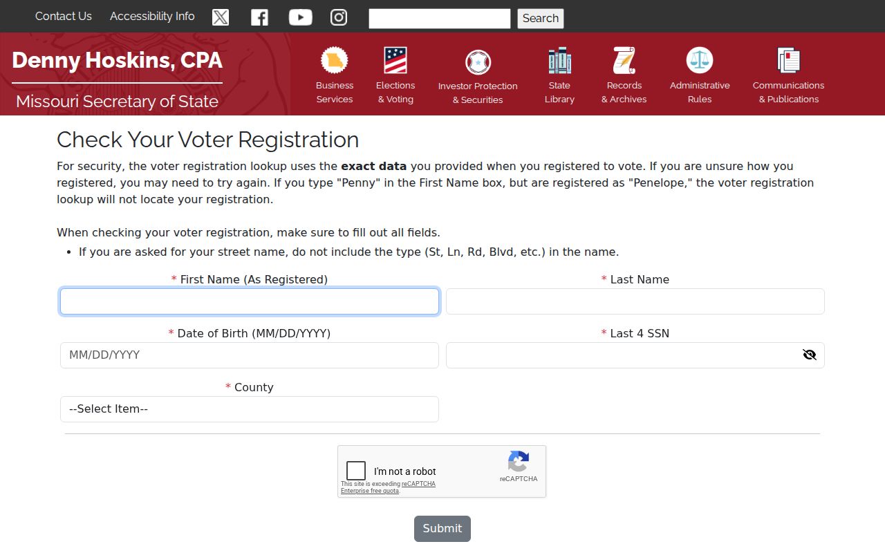
The required fields are a reminder to use voter information narrowly and to avoid treating it as a broad Liberty residents list.
Liberty Records Beyond Portals
Not every Liberty record has an online index. Missouri’s Sunshine Law directs a requester to the custodian holding the record. RSMo §610.023 requires a response by the end of the third business day after receipt, either by providing access, explaining a delay, or citing the basis for a denial. A focused request names the agency, record type, date range, parcel ID or case number, and preferred format.
Clay County’s request form goes to the county Sunshine custodian at 1 Courthouse Square and explains paper-copy, media, and research fields. It also notes that a request becomes a public record. For a historic gap, the better route may be Clay County Archives, Missouri State Archives, a catalog search, or the clerk’s office rather than a broad request for every record about a person.
- Roll
- A list maintained for a specific administrative purpose, not a universal population list.
- Index
- A finding tool that points to a record, image, book, or file.
- Criss-cross directory
- An address-arranged directory, if a repository verifies that its shelf holds one.
- Parcel
- A tax and mapping unit, separate from a house number or mailing address.
Note: A narrow request produces a better search trail and a clearer fee estimate than an open-ended name request.
Liberty Historical Resident Directories
Historical Liberty resident directories preserve dated place information rather than a current household list. FamilySearch catalogs identify R. L. Polk & Co. Liberty directories for 1975, 1983, and 1986, with the 1986 title also including Clay County rural residents. The Liberty architectural survey identifies telephone directories from 1929 through 1994 at Clay County Archives and Liberty City Hall. Catalog availability and image access can vary, so confirm the specific volume before a visit.
Missouri Digital Heritage describes city directories as annual resources that can tie a historical name to an address, occupation, business, forwarding address, or death notice. The Liberty city directories collection explains the full historical shelf, including how to read entries and trace years. Directory names need comparison with the original page and another dated source.
A directory entry is a dated lead, not evidence that the person remains at that Liberty address. Missouri Digital Heritage is the online discovery route, while Clay County Archives and catalog holders can supply the on-site or restricted-access fallback.
Liberty Cemetery Research
Liberty’s cemetery map is a useful endpoint for local history and genealogy. The city identifies Fairview, New Hope, and Mt. Memorial, and its interactive map can search a deceased person by last name or year of death, locate a plot, and print a map. The system is updated monthly. A plot or marker can connect a name to a burial location and death-year context, but it does not prove the person’s final residence or full family history.
Clay County Archives cemetery and obituary work, Missouri death collections, and historical newspapers can add source leads. Compare spelling, dates, and repository notes before drawing a conclusion. Mt. Memorial’s public-burying-ground deed dates to 1836, an example of how Liberty’s local record story reaches far earlier than a modern online search screen.
Liberty Neighborhood Source Labels
Neighborhood names can help orient Liberty research, but they do not all mean the same thing. The city’s 2021 draft informational map includes names such as Bent Oaks, Clay Meadows, College Place West, Dougherty Historic District, Riverwood, and Withersfield. Some mark subdivisions, some identify historic districts, and some relate to associations. The map is not survey accurate and is not a membership record.
The Clay GIS map adds city limits, lots, subdivisions, roads, taxing districts, zoning, and 2024 orthophoto context. It is useful when an address may be inside Liberty, elsewhere in Clay County, or linked to a different postal arrangement. Use the parcel result for a location claim, not a ZIP or neighborhood label alone.
Liberty Record-Keeping Timeline
Liberty was founded in 1822 and incorporated in 1829. Its records span courthouse books, maps, permits, newspapers, and digital portals. The available chronology explains why a resident or house-history search may require more than one repository.
| Period | Documented Liberty record path |
|---|---|
| 1822 onward | Clay County recorder, court, probate, and related county series. |
| 1883–1924 | Sanborn Fire Insurance Maps identified by the Liberty architectural survey. |
| 1929–1994 | Liberty telephone directories at local repositories. |
| 1968 to date | Recorder-described internet-access period, with older materials needing extra navigation. |
| August 1999 onward | Recorder-described daily imaging period. |
The 211 N Gallatin survey example combines a 1912 water connection, a 1914 atlas note, directory entries, and later sources. It is a model for documenting a historical address trail without asserting anything about a current resident.
Liberty Records Changes
Access details can change. Clay County Archives reported a 2026 expansion of electronically available newspapers, including Liberty-area material that remains relevant to directory and family-history research. The expansion may mean a searchable scan rather than a complete run or unrestricted download, so the archive should confirm title coverage and access conditions.
The Recorder announced a fee adjustment effective August 28, 2026. Missouri DHSS also describes vital-record modernization phases extending through 2027. Those developments do not change the underlying access limits. Check the official fee, application, and repository pages before ordering a copy or relying on a portal label.
Liberty Privacy Limits
Public availability is not a reason to aggregate every field. Avoid full dates of birth, Social Security numbers, protected voter addresses, medical details, victim or witness information, sealed matters, and a sensitive person’s current address. Missouri Safe at Home provides eligible participants with a substitute address for new government and court records, although it does not erase older records. Vital-record access is restricted by direct-and-tangible-interest rules.
Use records lawfully. Liberty record sources are for careful personal, historical, civic, and family research. Do not use an address, map, or index to stalk, harass, intimidate, or harm anyone. Confirm an error with the custodian that maintains the original record.
Official rolls and archive records are usually more transparent about source and date than commercial people-finder products. They may be slower, but they show the custodian, scope, and correction path. When two records conflict, preserve the discrepancy and ask the office or repository that produced the record.