
Search Liberty Streets by Address
For a Liberty street directory question, separate the property from the people connected to it. The Clay County Assessor parcel search supplies the current situs, parcel identifiers, owner and deed-reference fields. Clay GIS then adds lot, subdivision, city-limit, road, and district context. ClayDeeds is the next stop for a recorded instrument, but it is a party-name and book/page index, not an address search. The Missouri voter lookup is designed to confirm an individual registration with identifying information, not to create an address roster. Historical telephone or reverse-directory work belongs at the archive after the parcel trail is clear.
- Enter the address in the Clay County Assessor Parcel Search. Record the Prop ID, Parcel ID, situs, map description, and the Deed tab's instrument or book/page reference.
- Open the same parcel in the Clay County GIS map. Use the parcel, road, subdivision, city-limit, and district layers to confirm which location the result represents.
- Use the deed reference or a party name in ClayDeeds. Read document type and date before drawing any conclusion about a transfer.
- For a person's own registration question, use the Missouri voter lookup with the required registered information. It is not a reverse street search.
- For dated household research, ask Clay County Archives about the relevant street, directory volume, newspaper, map, or permit material rather than assuming every year is online.
That address-to-owner-to-deed sequence is the useful core of a street-by-street search. It keeps a current tax record, a recorded document, and a historical directory entry in their proper lanes.
Liberty Parcel Search Tip
The Assessor portal is the starting tool for a Liberty street address because it connects the common address to the county's parcel keys. Its visible helper text names Parcel ID, Prop ID, Subdivision Name, and Tax Code as search terms. Address mode returns matches with a score and coordinates. Results are capped at 200 and sorted by Parcel ID, so a broad street search may need a house number or another narrowing detail. The portal states that map description is not for legal documents.
| Clay parcel field | Use in a street search | Important limit |
|---|---|---|
| Prop ID and Parcel ID | County keys for matching the assessor card and GIS result | They identify a parcel, not a current household. |
| Situs and owner fields | Separate the property location from owner mailing information | A mailing address can be elsewhere and should not be republished unnecessarily. |
| Map description | Useful orientation within a subdivision or map area | The assessor says it is not a legal description. |
| Use, property type, and value rows | Tax and assessment context for the parcel | Assessment is not a sale price or a private appraisal. |
| Deed tab | Instrument, book, page, deed type, and deed date | The recorder, not the assessor, maintains the instrument. |
Research tip: note the Deed tab before opening ClayDeeds. The Recorder's address limitation makes that book/page lead much more useful than repeating a street-name search.
Map a Liberty Street in GIS
Clay GIS helps place a Liberty address in its physical and governmental setting. It accepts a parcel ID or parcel prefix, allows parcel and subdivision polygon selection, and provides advanced search, measurement, coordinate display, screenshot-area selection, and layer controls. The layers include current and future-year parcels, lots, subdivisions, building footprints, roads, city limits, townships, school and fire districts, zoning, and 2024 orthophoto. That makes the map useful for checking a street's geometry or jurisdiction before contacting the appropriate office.
Clay County's GIS map shows the parcel, city-limit, road, subdivision, and layer tools used to orient a Liberty street search.
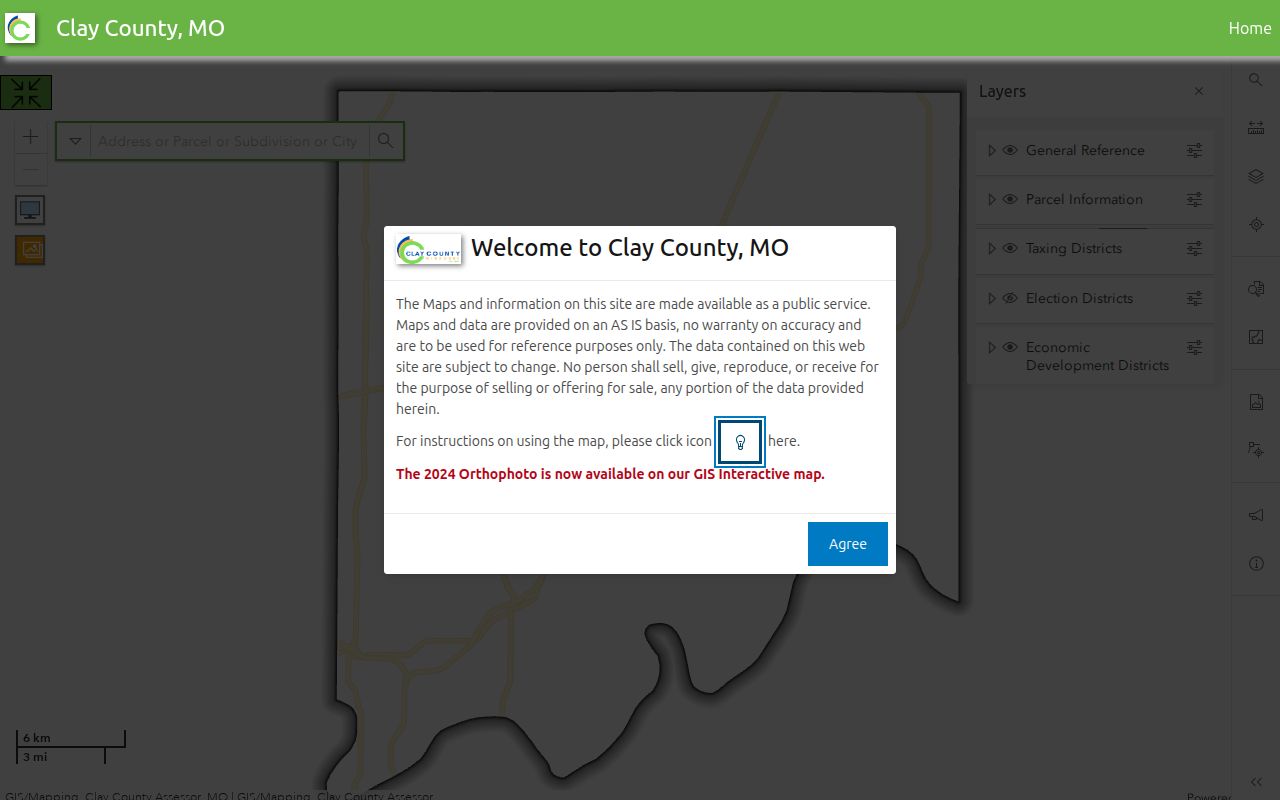
The map is a current orientation tool, not the official record. Clay County provides it AS IS and warns that a nearby parcel view does not establish a relationship between people or prove present residence.
Liberty Deed Links by Address
A deed trail begins with the address only indirectly. After the assessor supplies a likely party name, instrument number, or book and page, ClayDeeds offers Indexes/Name, Browse Name, Book/Page, Financing Statement, and Instrument-number routes. The name search offers Standard, Contains Text, and Sounds Like options, party roles, entity choices, date fields, and date or name sorting. Older material also has designated old-index ranges and non-indexed deed or plat image tools. Online search and image viewing require registration or login; the Recorder describes searching and viewing as free, while copies are purchased.
- Parcel
- A county tax and GIS unit tied to a Prop ID or Parcel ID. It is not the same thing as a household.
- Situs address
- The property location shown on the assessor record. It differs from an owner's mailing address.
- Plat
- A recorded map of a subdivision or land division, often located through its book and page reference.
- Criss-cross directory
- A historical directory arranged by address, used to locate dated occupant or business entries when a verified volume exists.
Recorder coverage has several eras: hand-recorded books from 1822 through 1986, an automated database from 1986, daily imaging from August 1999, and internet access the Recorder describes from 1968 to the present. Older books and non-indexed images may need special portal navigation or office help. A convenience image is not a certified record, and Clay County says sale price is not public record.
Liberty Permits Along a Street
The City of Liberty's SmartGov portal adds a different kind of address record. Its public home includes My Portal, Parcel Search, Reports/Documents, Building, Planning & Zoning, Historic Preservation, Occupation/Business License, Liquor, and Public Works. My Portal appears to handle applications, payments, inspections, and review. Parcel Search is intended for parcel information. The portal is useful for checking whether the city has a current administrative record, but it does not state a complete archive range and its dynamic public report filters were not captured in the research.
Liberty SmartGov is the official portal for the city's public permit, inspection, license, and parcel-facing services.
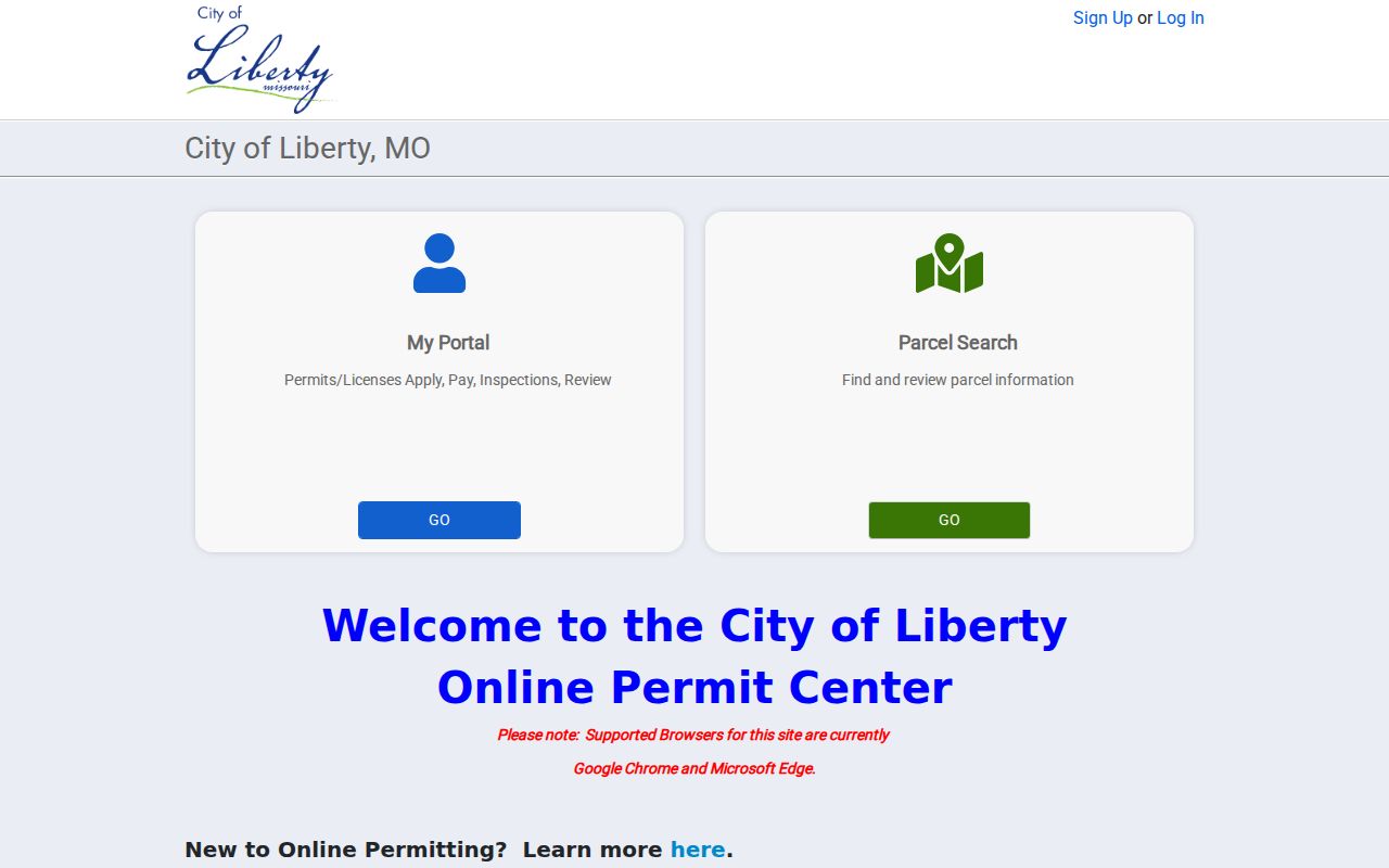
A permit or inspection indicates an administrative event. It does not prove a project was completed, that a home is occupied, or that a code matter was decided. Older or unindexed material should be requested from the relevant city or county Sunshine custodian, subject to exemptions, redactions, and fee estimates.
Liberty Street Records at a Glance
Each Liberty street record answers a different question. Combining them is useful only when the fields and dates agree. The address-record coverage below identifies the custodian, the kind of information visible, and the limits that keep a property result from becoming a household roster.
| Address record | Liberty-area keeper | What it can show | Access and era |
|---|---|---|---|
| Parcel and tax card | Clay County Assessor | Prop ID, Parcel ID, situs, owner/co-owner, tax geography, use, values, deed reference | Free current portal; full archive range not published. |
| GIS parcel layers | Clay County GIS | Geometry, lots, subdivisions, districts, roads, footprints, and orthophoto | Free current map with named 2024 orthophoto; not an official record. |
| Recorded instrument | Clay County Recorder of Deeds | Grantor/grantee, instrument or book/page, document type, and date | Hand books 1822-1986; automated from 1986; internet described from 1968. |
| Permit or inspection | Liberty SmartGov and Building | Current permit, parcel, project, inspection, or status fields as exposed | Current portal; historic public coverage not stated. |
| Historic map or directory | Clay County Archives, MDH, and FamilySearch | Dated address, occupant, business, plat, atlas, or Sanborn context | Verified local eras include 1883-1924 maps and 1929-1994 telephone directories. |
For personal voter-status questions, Missouri's lookup requires the name exactly as registered, date of birth, last four Social Security digits, and county. State law describes limited public voter fields and protects qualifying addresses. It does not provide a public list of everyone on a Liberty street.
Historic Liberty Street Numbers
Older Liberty street research takes more than a modern address. The historic property survey points to a 1914 atlas, city plat maps, water permits, building permits on microfilm, Sanborn Fire Insurance Maps from 1883 to 1924, telephone directories from 1929 to 1994, and a 1988 church directory. A source may use a lot, block, owner name, or an earlier form of an address. Preserve what the source actually says instead of quietly changing it to fit a modern parcel card.
The survey's 211 N Gallatin example is a useful model for a dated house history. It reports water turned on in 1912, an unnamed lot in a 1914 atlas, W.W. Cosby and Jack Massey in 1929 directory entries, and later George R. and Alice I. Crockett directory entries. Those statements belong to their cited historical sources. They are not a current occupant finding. The precise Liberty-wide renumbering chronology was not located, so an unresolved address conflict should remain marked as a research gap.
Clay County Archives has city records, newspapers, photographs, genealogy resources, and historical material. The Missouri State Archives adds Clay County microfilm and county/municipal record discovery. Ask for the collection, street or surname, date range, and whether a scan or transcription is needed.
Requesting Older Liberty Street Records
When an address record is not indexed online, use the Missouri Sunshine Law route with the agency that holds it. Chapter 610 requests should go to the records custodian, not to a portal provider. RSMo §610.023 calls for access, a delay explanation, or a denial citing its legal basis by the end of the third business day after receipt. Clay County's request form asks for the record type, date period, delivery preference, and contact information, and it notes that a request itself becomes a public record.
For a property request, give the parcel ID and instrument or book/page if known, not merely a broad street name. Clay County lists sunshine@claycountymo.gov and 816-407-3570 for requests at 1 Courthouse Square. Its posted copy charge is $0.10 per paper page or $0.20 double-sided, with other permitted charges possible. The Missouri Attorney General's Sunshine Law information explains the statewide process, while Clay County's form supplies the local fields.
Limits of a Liberty Street Directory
A street directory cannot establish every person connected to an address. The assessor identifies parcel and ownership fields, while a GIS map describes location and layers. A Recorder instrument documents a filing, not a complete life history. The SmartGov portal does not publish a complete searchable code-enforcement history on its public pages. Court and voter systems have their own confidential, protected, or access-limited fields. Mailing ZIPs are postal routing areas, not proof of Liberty city limits or residence.
Missouri Safe at Home provides a substitute address for qualifying survivors and does not erase existing records. Protected voter addresses, sealed court material, full dates of birth, Social Security numbers, private contact details, and sensitive current-location information should not be pursued or republished. For a correction, contact the Assessor or GIS office for parcel data, the Recorder for recorded documents, and the city or County Planning and Zoning for address authority according to the Clay GIS FAQ.