
Liberty ZIP Code Directory Coverage
Missouri’s official ZIP and city dataset identifies two ZIP codes for Liberty in Clay County: 64068 and 64069. That is the verified starting point for a Liberty ZIP code directory, not a map of every delivery route or municipal boundary. The state list identifies the city and county, while USPS and Clay County records supply different parts of the answer for a particular address. Neither source supports assigning neighborhoods, exact address ranges, or resident counts to either code without a more specific postal or parcel check.
| ZIP | Areas Covered in the Verified Source | Post Office | Notes |
|---|---|---|---|
| 64068 | Liberty, Clay County, in Missouri’s official ZIP/city list | USPS Liberty Post Office, 1000 Progress Drive, Liberty, MO 64068-9998 | Exact address ranges and city-limit overlap were not exposed in the official sources reviewed. |
| 64069 | Liberty, Clay County, in Missouri’s official ZIP/city list | No dedicated station was exposed in the reviewed sources | Do not assume a PO Box role, delivery range, or city-limit status without USPS confirmation. |
The Missouri ZIP/city reference is useful for the city-and-county association. It does not turn the two codes into fixed geographic polygons. For a named location, use the USPS Liberty Post Office listing for postal context and move next to the parcel and GIS records for jurisdiction.
Liberty ZIP Code Postal Anchor
The official USPS Liberty Post Office page is the postal-location source shown below. It identifies the Liberty office at 1000 Progress Drive with the 64068-9998 postal address and lists its contact and service information. That page is evidence about the post office, not a statement that every 64068 address lies inside Liberty’s city limits.
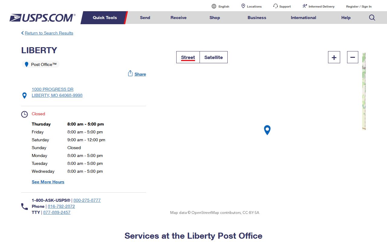
Use the USPS source to verify a delivery question or post-office detail, then compare a physical address with Clay County’s parcel data. The directory keeps those tasks separate because a postal designation is not a parcel boundary, a city boundary, or proof that someone resides at an address.
Liberty ZIP Code Search Field Limits
A ZIP-wide resident roster was not verified in the county or state portals. The most useful official tools each take a different set of fields. Their limits are just as important as their search boxes: the voter tool is an exact personal confirmation route, the assessor’s selector is dynamic, and the GIS map is parcel based. A Liberty ZIP code search should document what the tool can actually receive rather than pretending a postal code is a universal filter.
| Official source | Visible search fields or modes | ZIP limitation |
|---|---|---|
| Missouri voter lookup | First name as registered, last name, date of birth, last four SSN digits, and county | All identifying inputs are required. It is not a ZIP-wide or reverse-address roster. |
| Clay County Assessor Parcel Search | Dynamic selector with visible Parcel ID, Prop ID, subdivision name, tax code, and address matching | A complete selector list was not exposed, so no live ZIP filter is confirmed. |
| Clay County GIS map | Parcel ID or map term, advanced search, parcel and subdivision selection, layers, and measure tools | No verified ZIP-wide mode was documented. |
| USPS Liberty Post Office | Postal-location information for the Liberty office | The reviewed page did not expose complete 64068 or 64069 address-range data. |
The Assessor’s results can include Prop ID, Parcel ID, owner, situs, and map description. The GIS map can show a selected parcel, lots, subdivisions, roads, city limits, taxing layers, and 2024 orthophoto context. Both tools are useful after a specific address is known. The GIS service states that it is not the official record, and its map description is not a legal description.
Note: A portal that does not expose a ZIP field should not be described as if it can supply a complete Liberty ZIP code search.
Finding a Liberty Address by ZIP Code
A ZIP code can narrow the starting area, but a reliable record trail ends with a parcel or custodian. Use only the few facts needed for the question. The workflow below retains the postal check while avoiding unsupported claims about people who may share a ZIP. Once an address has been confirmed, the street-level record path is covered in the Liberty by-street directory.
- Confirm that the address uses 64068 or 64069 through USPS or the official Missouri ZIP/city reference.
- Search the known address in the Clay County Assessor portal and retain the Prop ID, Parcel ID, situs, and deed reference rather than a mailing label alone.
- Open the same parcel in Clay GIS to check city limits, lot or subdivision context, and the map’s jurisdiction layers.
- If a record is not online, ask the custodian for the parcel ID, exact address, record type, and date range instead of requesting all records tied to a ZIP.
The Missouri voter lookup should be used only by a person who can supply the required registered information, including date of birth and last four SSN digits. Missouri law lists specific voter-file fields and limits commercial use; it does not make a ZIP a public tool for identifying every voter. A court or recorder index likewise needs its own fields and should not be treated as a ZIP roster.
Liberty ZIP Code and City Boundaries
ZIP geography is postal geography. It can cross a city boundary, include nearby unincorporated territory, or use a mailing city that differs from the authority that controls the address. The Census ZCTA files are statistical approximations rather than exact USPS boundaries. For Liberty, the research confirms 64068 and 64069 in the state list but does not establish their exact delivery ranges or the detailed postal role of 64069. Those gaps should remain visible instead of being filled with a map guess.
The Clay GIS FAQ directs address changes inside city limits to the City of Liberty and changes outside city limits to County Planning and Zoning. Start with the parcel map when jurisdiction is unclear. A mailing ZIP may help direct the question, yet the parcel result and the responsible office should control a location claim. This distinction is especially useful when the record concerns a permit, a deed, a planning question, or a historical address.
- ZIP and ZIP+4
- A five-digit ZIP routes mail broadly. ZIP+4 adds delivery detail, but it does not create a legal parcel boundary.
- PO Box ZIP
- A postal code used for post-office boxes. The reviewed sources do not establish whether 64069 has that status.
- Unique ZIP
- A code assigned to a single organization or high-volume recipient. No such status was verified here for either Liberty code.
- Carrier route
- A postal delivery sequence. It is not evidence of city limits, parcel ownership, or household membership.
Liberty ZIP Code, Situs, and Legal Description
The Assessor’s record separates a property’s situs, or physical property location, from owner mailing information. Its details can also show a map description, use code, tax area, and section, township, and range fields, plus a deed-tab instrument or book/page. A map description is expressly not for legal documents. The Recorder’s index is another separate system: ClayDeeds searches names, instruments, book/page, and UCC fields, not street addresses or ZIP codes.
For a deed question, start with the assessor’s parcel and its book/page lead, then use ClayDeeds to locate the recorded instrument. ClayDeeds describes hand-recorded books from 1822 through 1986, an automated database beginning in 1986, daily imaging from August 1999, and internet access described as 1968 to date. Older or non-indexed material may need special navigation or help from the Recorder. The ZIP code directory does not replace that address-specific work.
Liberty ZIP Code City-County Routing
A ZIP result that raises a government-record question has a practical next stop. Liberty building information and the city’s SmartGov portal provide current permit and parcel entry points, although complete historical filters and retention ranges were not published. The county parcel and GIS portals provide the current property context. For a historic address, Clay County Archives, city records, historic maps, telephone directories, permits, and newspapers can help, but each has its own dates and access route.
When the online route stops, send a focused Sunshine request to the agency that holds the record. The Clay County form supports a record description and date period, and RSMo §610.023 sets the response framework under Missouri’s Sunshine Law. Ask for the relevant department, parcel, address, record type, and period. Do not ask an office to build a broad resident list from a postal code.
Liberty ZIP Code Directory Myth Check
A ZIP code does not prove city limits or residency. That is the key local caution behind every Liberty ZIP code directory search. The official Missouri list, USPS location page, GIS layers, and Assessor portal each describe one part of a location. They should be read together only where their fields overlap, and a conflict should be recorded as unresolved until the responsible custodian corrects it.
The city’s 2021 neighborhood map is also informational and not survey accurate. It names historic districts, subdivisions, associations, and other local labels, but those names do not become parcel boundaries or membership lists. Use geographic tools to orient a lawful records search, not to infer relationships between people or homes.